| Welten's Distribution Maps |
|
LMLK Home Biblical Accounts NonBiblical Accounts Theories HBRN MMST SUKE ZYF Generic x (cannot classify) 2-Top 2-Divided 2-Undivided 4-Cursory 4-Lapidarist Jars Personal Seals Incisions Paleography Typologies Corpus Stratigraphy Geography Displays Publications Credits Updates 
|
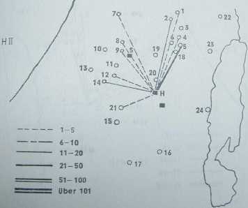
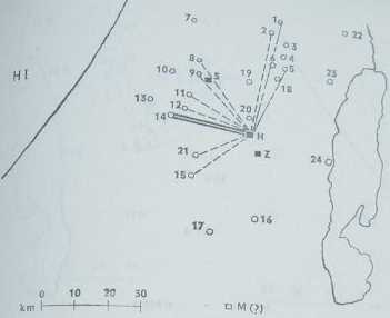
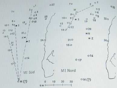
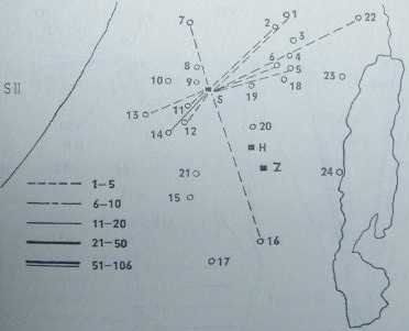
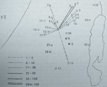
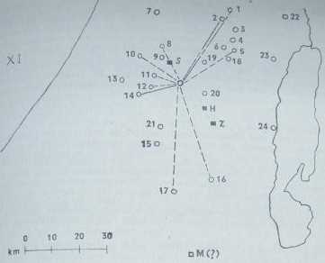
In "Die Konigs-Stempel", Peter Welten drew the following maps to illustrate the hypothetical distribution of LMLK jars from the 4 inscription words & the 2 icons. The numbers on the maps correspond to cities listed below; the shape of the lines drawn from the distribution centers represents the quantity of LMLK handles found up to Welten's publication date (in 1969 his corpus contained 804), & the exact totals he worked with are shown in parentheses next to the city names (refer to the Corpus page for a more detailed breakdown of sub-quantities).
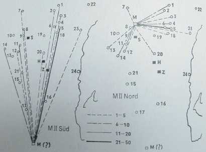 Note: The left map ("Sud") assumes MMST=Kurnub; the right map ("Nord") uses a theoretical, geographically central point.
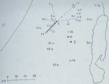
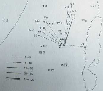
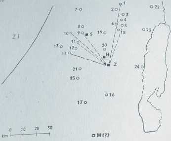
 Note: These 2 maps use a theoretical, geographically central point.
|
|
Number of visits: |
This page was created on March 14, 2002, & last updated on March 14, 2002 |
